Buffalo County (South Dakota)
| Verwaltung | |
|---|---|
| US-Bundesstaat: | South Dakota |
| Verwaltungssitz: | Gann Valley |
| Gründung: | 1873 |
| Demographie | |
| Einwohner: | 1.948 (Stand: 2020) |
| Bevölkerungsdichte: | 1,6 Einwohner/km² |
| Geographie | |
| Fläche gesamt: | 1262 km² |
| Wasserfläche: | 44 km² |
| Karte | |
 | |
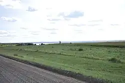
Buffalo County[1] ist ein Bezirk im Bundesstaat South Dakota der Vereinigten Staaten. Das U.S. Census Bureau hat bei der Volkszählung 2020 eine Einwohnerzahl von 1948[2] ermittelt. Der Verwaltungssitz (County Seat) ist Gann Valley.
Geographie
Das County hat eine Fläche von 1262 Quadratkilometern; davon sind 44 Quadratkilometer (3,45 Prozent) Wasserflächen.
Geschichte
Das County wurde am 6. Januar 1864 gegründet und nach den Bisonherden in der Gegend benannt.[3]
Zwei Orte im County haben den Status einer National Historic Landmark, die Crow Creek Site und die Fort Thompson Mounds.[4] Sechs Bauwerke und Stätten des Countys sind im National Register of Historic Places (NRHP) eingetragen (Stand 30. Juli 2018).[5]
Bevölkerungsentwicklung
| Bevölkerungsentwicklung | |||
|---|---|---|---|
| Census | Einwohner | ± rel. | |
| 1900 | 1.790 | — | |
| 1910 | 1.589 | −11,2 % | |
| 1920 | 1.715 | 7,9 % | |
| 1930 | 1.931 | 12,6 % | |
| 1940 | 1.853 | −4 % | |
| 1950 | 1.615 | −12,8 % | |
| 1960 | 1.547 | −4,2 % | |
| 1970 | 1.739 | 12,4 % | |
| 1980 | 1.795 | 3,2 % | |
| 1990 | 1.759 | −2 % | |
| 2000 | 2.032 | 15,5 % | |
| 2010 | 1.912 | −5,9 % | |
| 2020 | 1.948 | 1,9 % | |
| Vor 2020[6] aktuell[2] | |||
Dörfer
Weblinks

Einzelnachweise
- ↑ Buffalo County. In: Geographic Names Information System. United States Geological Survey, United States Department of the Interior, abgerufen am 22. Februar 2011 (englisch).
- ↑ a b Buffalo County, South Dakota. United States Census Bureau, abgerufen am 6. Januar 2026 (amerikanisches Englisch).
- ↑ Charles Curry Aiken, Joseph Nathan Kane: The American Counties: Origins of County Names, Dates of Creation, Area, and Population Data, 1950–2010. 6. Auflage. Scarecrow Press, Lanham 2013, ISBN 978-0-8108-8762-6, S. 35.
- ↑ Listing of National Historic Landmarks by State: South Dakota. National Park Service, abgerufen am 30. Juli 2018.
- ↑ Suchmaske Datenbank im National Register Information System. National Park Service, abgerufen am 30. Juli 2018.
- ↑ Decennial Census by Decade. U.S. Census Bureau, abgerufen am 5. Januar 2026 (amerikanisches Englisch).

Liste der Countys in South Dakota
Aurora |
Beadle |
Bennett |
Bon Homme |
Brookings |
Brown |
Brule |
Buffalo |
Butte |
Campbell |
Charles Mix |
Clark |
Clay |
Codington |
Corson |
Custer |
Davison |
Day |
Deuel |
Dewey |
Douglas |
Edmunds |
Fall River |
Faulk |
Grant |
Gregory |
Haakon |
Hamlin |
Hand |
Hanson |
Harding |
Hughes |
Hutchinson |
Hyde |
Jackson |
Jerauld |
Jones |
Kingsbury |
Lake |
Lawrence |
Lincoln |
Lyman |
Marshall |
McCook |
McPherson |
Meade |
Mellette |
Miner |
Minnehaha |
Moody |
Oglala Lakota |
Pennington |
Perkins |
Potter |
Roberts |
Sanborn |
Spink |
Stanley |
Sully |
Todd |
Tripp |
Turner |
Union |
Walworth |
Yankton |
Ziebach
Koordinaten: 44° 5′ N, 99° 12′ W